Browse park:
By state
Alabama
Alaska
Arizona
Arkansas
California
Colorado
Connecticut
Delaware
Florida
Georgia
Hawaii
Idaho
Illinois
Indiana
Iowa
Kansas
Kentucky
Louisiana
Maine
Maryland
Massachusetts
Michigan
Minnesota
Mississippi
Missouri
Montana
Nebraska
Nevada
New Hampshire
New Jersey
New Mexico
New York
North Carolina
North Dakota
Ohio
Oklahoma
Oregon
Pennsylvania
Rhode Island
South Carolina
South Dakota
Tennessee
Texas
Utah
Vermont
Virginia
Washington
West Virginia
Wisconsin
Wyoming
Search:
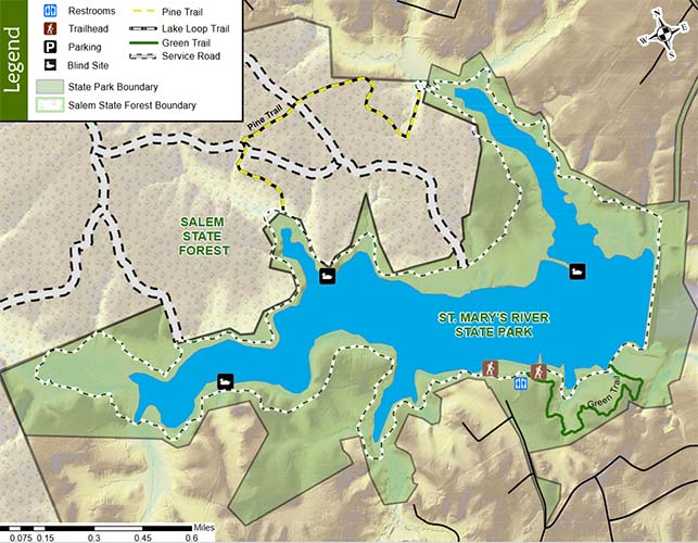
St. Mary's River State Park
Maps
Leonardtown,
MD
Home
MD
St. Mary's River State Park
Download files (4):
View: All Files
All Files
Park Maps
Trail Map
Park Map
Trail Map
Previous park
Next park
Nearby
Parks
State Parks near St. Mary's River State Park
Greenwell State Park
MD
6.74 miles away
Calvert Cliffs State Park
MD
9.79 miles away
Newtowne Neck State Park
MD
10.29 miles away
St. Clements Island State Park
MD
13.05 miles away
Point Lookout State Park
MD
17.53 miles away
Harriet Tubman UGRR
MD
23.97 miles away
