Browse park:
By state
Alabama
Alaska
Arizona
Arkansas
California
Colorado
Connecticut
Delaware
Florida
Georgia
Hawaii
Idaho
Illinois
Indiana
Iowa
Kansas
Kentucky
Louisiana
Maine
Maryland
Massachusetts
Michigan
Minnesota
Mississippi
Missouri
Montana
Nebraska
Nevada
New Hampshire
New Jersey
New Mexico
New York
North Carolina
North Dakota
Ohio
Oklahoma
Oregon
Pennsylvania
Rhode Island
South Carolina
South Dakota
Tennessee
Texas
Utah
Vermont
Virginia
Washington
West Virginia
Wisconsin
Wyoming
Search:
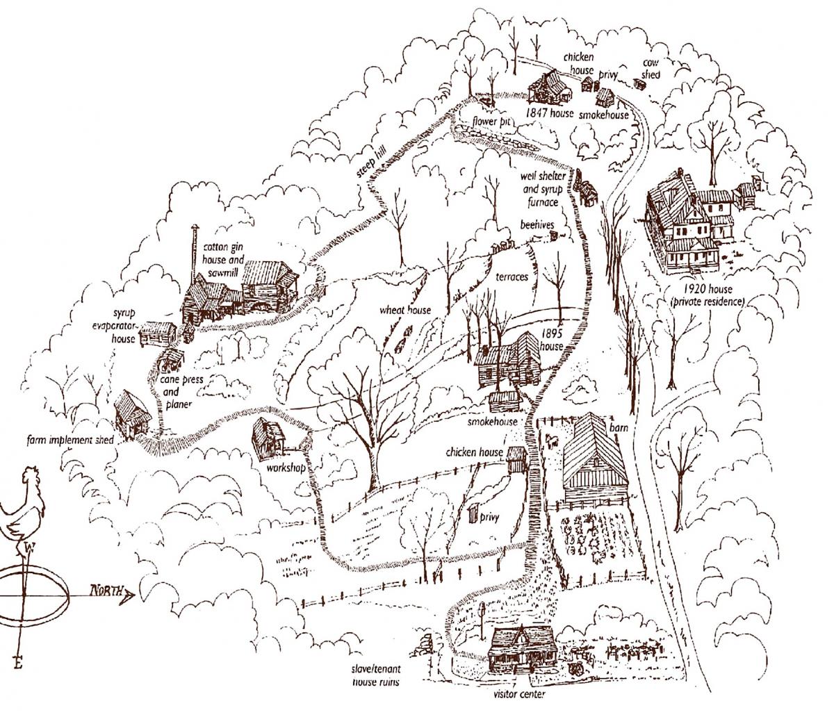
Jarrell Plantation Historic Site
Maps
Juliette,
GA
Home
GA
Jarrell Plantation Historic Site
Download files (1):
View: All Files
All Files
Park Maps
Park Map & Brochure
Previous park
Next park
Nearby
Parks
State Parks near Jarrell Plantation Historic Site
Indian Springs State Park
GA
18.51 miles away
High Falls State Park
GA
19.36 miles away
Hard Labor Creek State Park
GA
42.60 miles away
Panola Mountain State Park
GA
47.64 miles away
Hamburg State Park
GA
55.56 miles away
Roosevelt's Little White House Historic Site
GA
57.29 miles away
