Browse park:
By state
Alabama
Alaska
Arizona
Arkansas
California
Colorado
Connecticut
Delaware
Florida
Georgia
Hawaii
Idaho
Illinois
Indiana
Iowa
Kansas
Kentucky
Louisiana
Maine
Maryland
Massachusetts
Michigan
Minnesota
Mississippi
Missouri
Montana
Nebraska
Nevada
New Hampshire
New Jersey
New Mexico
New York
North Carolina
North Dakota
Ohio
Oklahoma
Oregon
Pennsylvania
Rhode Island
South Carolina
South Dakota
Tennessee
Texas
Utah
Vermont
Virginia
Washington
West Virginia
Wisconsin
Wyoming
Search:
Chicot State Park
Maps
Ville Platte,
LA
Home
LA
Chicot State Park
Download files (4):
View: All Files
All Files
Park Maps
Guides
Trail Map
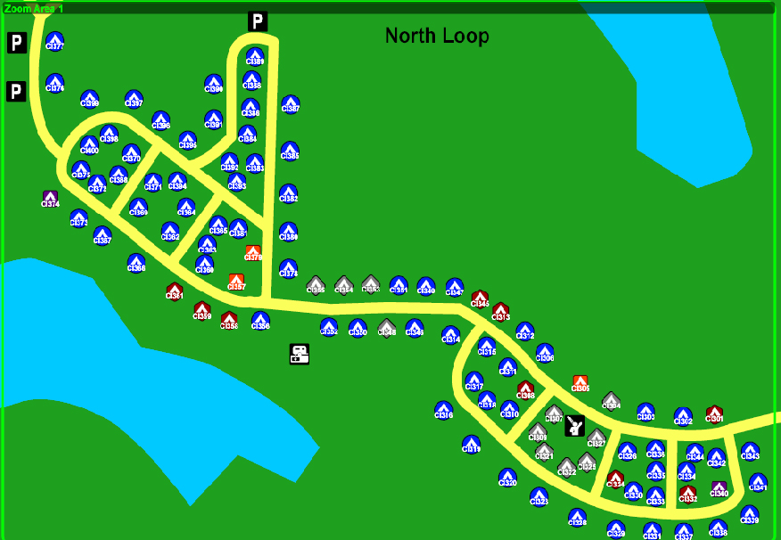
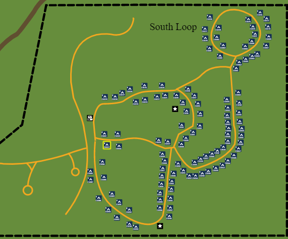
Campground Map
Campground Map
Brochure
Previous park
Next park
Nearby
Parks
State Parks near Chicot State Park
Louisiana State Arboretum State Preservation Area
LA
0.96 miles away
Marksville State Historic Site
LA
26.50 miles away
Kent Plantation House State Historic Site
LA
37.16 miles away
Forts Randolph & Buhlow State Historic Site
LA
37.89 miles away
Longfellow-Evangeline State Historic Site
LA
52.91 miles away
Rosedown Plantation State Historic Site
LA
53.82 miles away
